
Knights Road Connection Project
Consultation has closed.

The Knights Road Connection Project came to completion in July 2021 when the Council made decisions about the next steps following two on-road trials. Find out more about what was decided here.
The Knights Road Connection Project was one of several pilot projects funded by Waka Kotahi NZ Transport Agency that aim to create more people-friendly spaces in our towns and cities. The Innovating Streets programme provides the resources and support for Councils to work with their communities to find solutions that work for the people that use the streets and spaces the most.
Creating streets and spaces thatContinue reading
The Knights Road Connection Project came to completion in July 2021 when the Council made decisions about the next steps following two on-road trials. Find out more about what was decided here.
The Knights Road Connection Project was one of several pilot projects funded by Waka Kotahi NZ Transport Agency that aim to create more people-friendly spaces in our towns and cities. The Innovating Streets programme provides the resources and support for Councils to work with their communities to find solutions that work for the people that use the streets and spaces the most.
Creating streets and spaces that are more people-friendly make it easier to choose active modes of transport. This is important because New Zealand has a goal of 40% mode shift towards active transport and public transport by 2030. Working towards this goal will reduce congestion, help to meet climate targets and improve health. It's a big shift in a short time, and so this iterative way of working allows solutions to be tested quickly and cost effectively in the real world by all affected road users while change to the layout can still be made.
The aim is for more people to feel comfortable using active non-motorised modes of transport (bikes, scooters, e-scooters etc) for some of their shorter, regular journeys, or for the last kilometre after public transport. This will reduce the congestion and pressure on off-road parking, freeing up space for people for whom active modes are not practical. For people to feel comfortable using active transport there needs to be a safe, convenient and connected network that goes to the places people need to go to.

We’re trialling a new road layout along Knights Road connecting Waterloo Station to the Lower Hutt CBD. The aim of the trial is to make the journey a safer and more attractive connection regardless of how you choose to get around.
The new layout will create better connections between the Lower Hutt CBD, local schools, homes and workplaces and the public transport and active transport facilities at Waterloo station. The purpose of trialling these changes on the road is so that everyone who uses the road can see and feel the new layouts while there is still the potential to change them. We want to hear what is working, and what is not.
Our vision
Our bold goal is to find, through temporary trials, a design that becomes an attractive, well used shared-mode connection between Waterloo Station and the Lower Hutt CBD. We want students from local schools, and staff at local businesses to use the new road layout for commuting, improving the experience of all those that use the route.
Through the trial we are working with road users to find a safer layout for all modes of transports. Children on bikes, people on e-scooters and people walking on the footpath should feel safe using thing key connection, creating real transport choice.
Why did we choose Knights Road?
In Lower Hutt and across Wellington there is a lot of investment in shared paths and off-road cycleways, such as the Wainuiomata Shared Pathway, the new Beltway route under construction, the increasingly popular Hutt River Trail and the Melling to Ngauranga cycleway. These types of facilities are generally seen as safe, and allow travel between local suburbs and are close to public transport. What is missing is connections between these key routes, at key points, to the places people want to go - especially schools, shopping areas and workplaces.
- Knights Road is the connecting road between the public transport hubs at Waterloo Station and Queensgate.
- It is the link between the new Beltway route and Lower Hutt's CBD.
- There are six local schools on or near by Knights Road, and congestion at pick up and drop off times is an issue for all of them.
- Speed data along Knights Road showed that an unacceptable number of vehicles are exceeding 50km/h and some are driving at very high speeds for an urban environment.
- It is a wide road with enough space to trial changes to the road layout.
On this basis, a Knights Road connection to improve the connectivity of existing and planned shared paths and cycleways was first proposed as part of an urban cycleways package that included the Wainuiomata Shared Path (completed 2019, the Beltway Cycleway and the Eastern Bays Shared Path.
What has happened so far?
First trial road layout
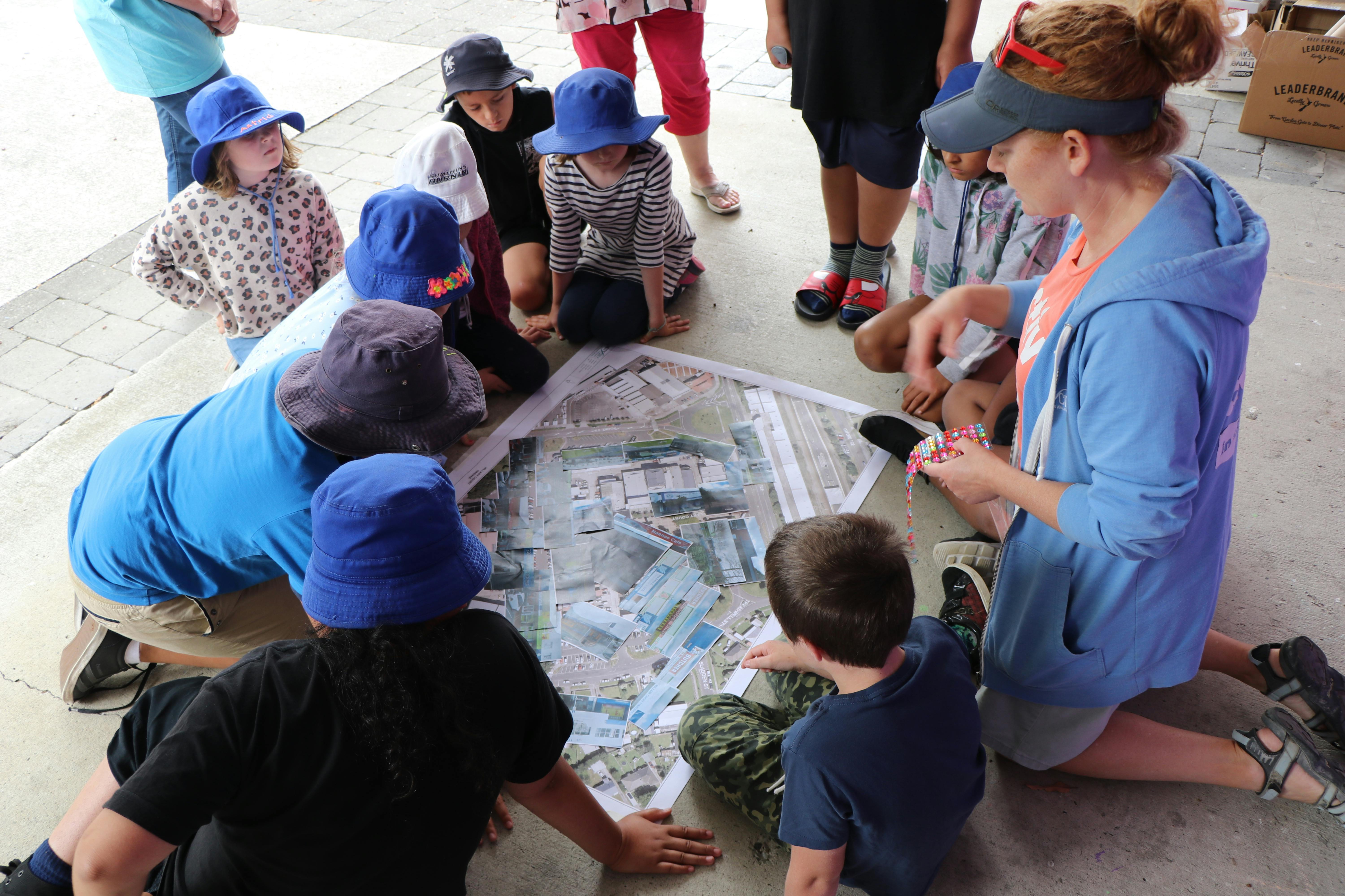
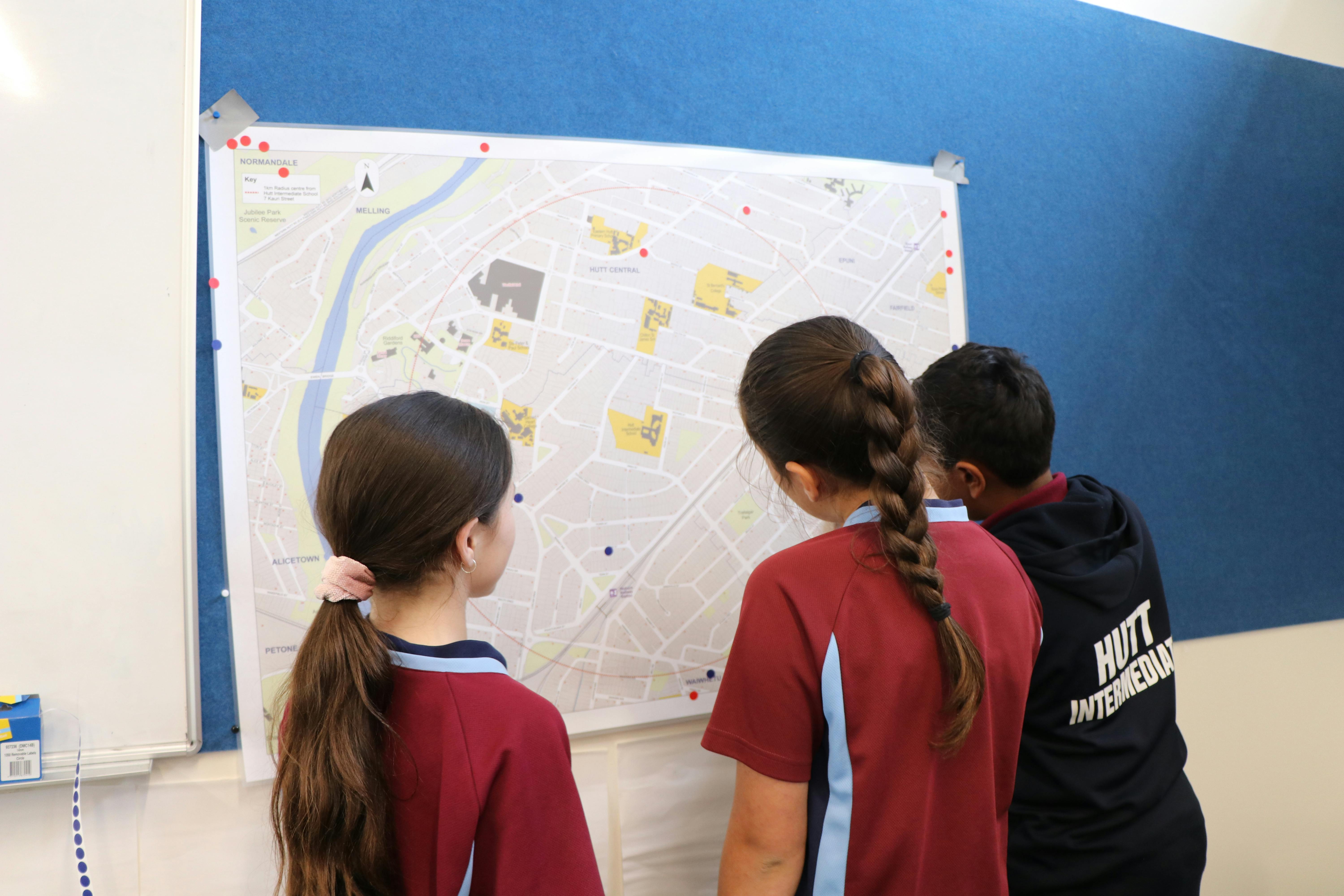
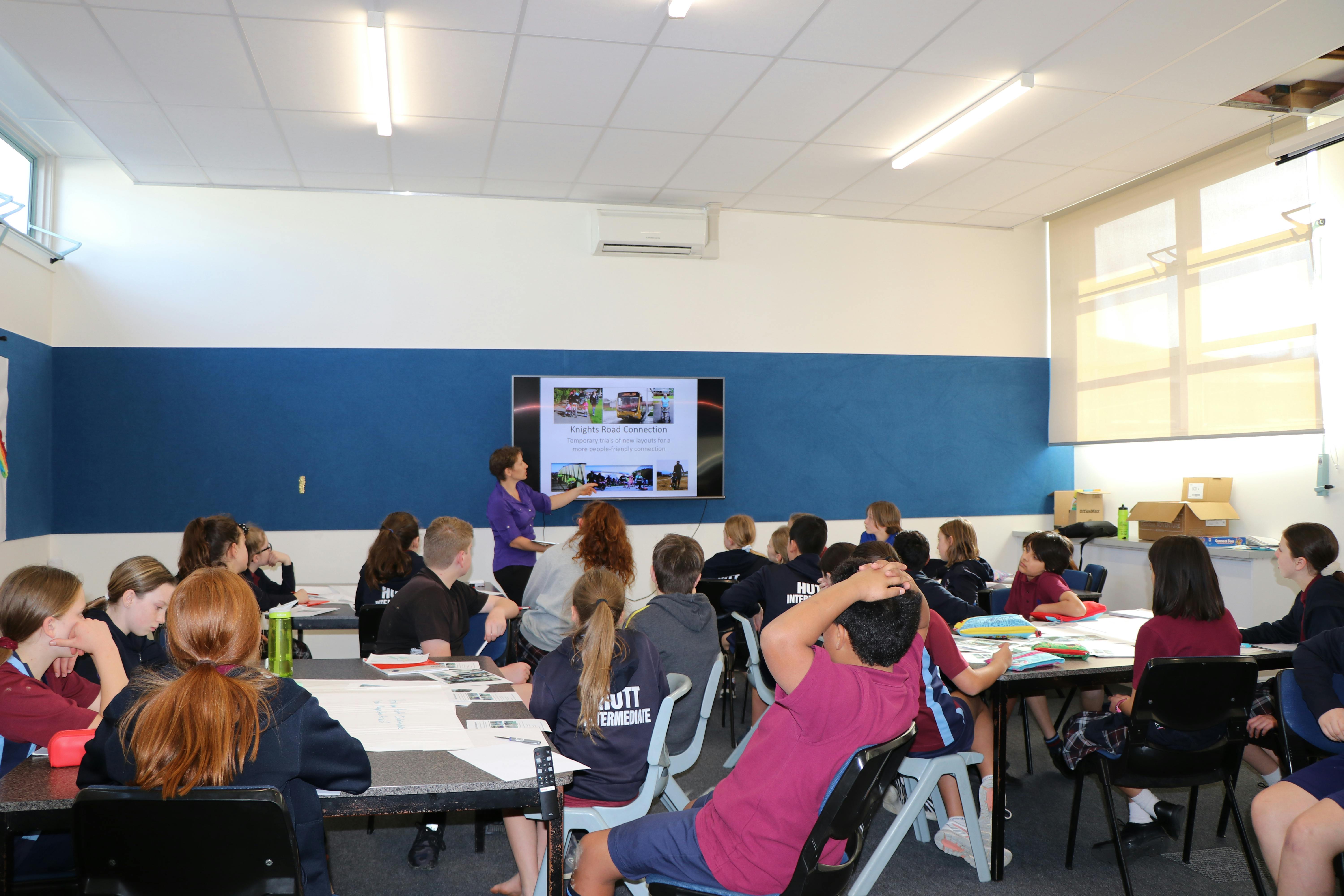
From July to October 2020, the Knights Road Connection project team ran a series of workshops and engagements with residents, schools and the local community to better understand their experiences on Knights Road, what is working well and what might need to change to make the connection work better for more people.
Based on the feedback we trialled a temporary road layout in Knights Road during March 2021. You can find out more about the results of that trial here or read the full report here


Amended trial road layout
Based on community feedback and data from the first trial, we are trialling an amended road layout. You can find out more about it here
How to get involved?
We are trialling the temporary changes in real time, using your recommendations to find the best solution for the space and the community. We need to hear from you about what works well and anything that isn’t working from the trial layout.
We'll be posting regular project updates, running surveys and Facebook polls, and collecting your ideas on how you want the space to work.
Thank you to the more than 300 of you who have filled in the online surveys. These are now closed, so that we can collate and understand your feedback. You can still share your ideas on the project page, attending a workshop or pop in session and/or emailing us.
Your feedback will be used alongside real-time traffic monitoring to help inform what might happen next.
Consultation has closed.
Have you got a question about this project not covered in our FAQs? Ask here and one of the team will aim to get back to you in a couple of working days.
-
Share So it begins. Last night there was an accident at 191 Knights Rd. A resident of 191 Knights Road pulled up outside to park the car on the street (she said her indicator was on). The car following hers smashed into her car, whipping it around, across the path so that her car went into the gate and fence. Though there are obvious questions around how much attention the driver of the other car was paying, it's also hard not to draw the conclusion that the narrowing of the lane on the north of Knights Road (with the median having been moved across) played a part in the accident. It's also hard to see that the same sort of accident is not going to happen again. The resident was simply pulling over to park on the road. An awful lot of residents will be pulling up even more slowly to enter their driveways. How many more accidents will there need to be to influence the decisions being made about the cycleway? With the lane on the north side being made that much narrower now, not only is it more dangerous for drivers, but where is the space for cyclists on the north side? I see that one of the criteria against which the trial will be assessed is the perception of safety. What about actual safety?! on Facebook Share So it begins. Last night there was an accident at 191 Knights Rd. A resident of 191 Knights Road pulled up outside to park the car on the street (she said her indicator was on). The car following hers smashed into her car, whipping it around, across the path so that her car went into the gate and fence. Though there are obvious questions around how much attention the driver of the other car was paying, it's also hard not to draw the conclusion that the narrowing of the lane on the north of Knights Road (with the median having been moved across) played a part in the accident. It's also hard to see that the same sort of accident is not going to happen again. The resident was simply pulling over to park on the road. An awful lot of residents will be pulling up even more slowly to enter their driveways. How many more accidents will there need to be to influence the decisions being made about the cycleway? With the lane on the north side being made that much narrower now, not only is it more dangerous for drivers, but where is the space for cyclists on the north side? I see that one of the criteria against which the trial will be assessed is the perception of safety. What about actual safety?! on X (formerly Twitter) Share So it begins. Last night there was an accident at 191 Knights Rd. A resident of 191 Knights Road pulled up outside to park the car on the street (she said her indicator was on). The car following hers smashed into her car, whipping it around, across the path so that her car went into the gate and fence. Though there are obvious questions around how much attention the driver of the other car was paying, it's also hard not to draw the conclusion that the narrowing of the lane on the north of Knights Road (with the median having been moved across) played a part in the accident. It's also hard to see that the same sort of accident is not going to happen again. The resident was simply pulling over to park on the road. An awful lot of residents will be pulling up even more slowly to enter their driveways. How many more accidents will there need to be to influence the decisions being made about the cycleway? With the lane on the north side being made that much narrower now, not only is it more dangerous for drivers, but where is the space for cyclists on the north side? I see that one of the criteria against which the trial will be assessed is the perception of safety. What about actual safety?! on Linkedin Email So it begins. Last night there was an accident at 191 Knights Rd. A resident of 191 Knights Road pulled up outside to park the car on the street (she said her indicator was on). The car following hers smashed into her car, whipping it around, across the path so that her car went into the gate and fence. Though there are obvious questions around how much attention the driver of the other car was paying, it's also hard not to draw the conclusion that the narrowing of the lane on the north of Knights Road (with the median having been moved across) played a part in the accident. It's also hard to see that the same sort of accident is not going to happen again. The resident was simply pulling over to park on the road. An awful lot of residents will be pulling up even more slowly to enter their driveways. How many more accidents will there need to be to influence the decisions being made about the cycleway? With the lane on the north side being made that much narrower now, not only is it more dangerous for drivers, but where is the space for cyclists on the north side? I see that one of the criteria against which the trial will be assessed is the perception of safety. What about actual safety?! link
So it begins. Last night there was an accident at 191 Knights Rd. A resident of 191 Knights Road pulled up outside to park the car on the street (she said her indicator was on). The car following hers smashed into her car, whipping it around, across the path so that her car went into the gate and fence. Though there are obvious questions around how much attention the driver of the other car was paying, it's also hard not to draw the conclusion that the narrowing of the lane on the north of Knights Road (with the median having been moved across) played a part in the accident. It's also hard to see that the same sort of accident is not going to happen again. The resident was simply pulling over to park on the road. An awful lot of residents will be pulling up even more slowly to enter their driveways. How many more accidents will there need to be to influence the decisions being made about the cycleway? With the lane on the north side being made that much narrower now, not only is it more dangerous for drivers, but where is the space for cyclists on the north side? I see that one of the criteria against which the trial will be assessed is the perception of safety. What about actual safety?!
LMD asked about 5 years agoThanks for your feedback and queries. We’re sorry to hear about this incident, and we acknowledge your comment about driver inattention. There is ample space in the median strip for drivers to avoid colliding with a slowing or stationery vehicle, and the width of the north lane meets regulations. The amended trial layout returns the north lane to how it was before the trials began, meaning that cyclists and vehicles share the space. We are trialling a separated pathway on the south side. You can find out more about the amended layout here
-
Share Have you looked at narrowing the white line down the center of the road. Widen the footpath on both sides with the cycle lane clearly marked. more expensive to do but ticks a lot more boxes. no loss of parking, cycles away from cars and you can fix the foot path at the same time. on Facebook Share Have you looked at narrowing the white line down the center of the road. Widen the footpath on both sides with the cycle lane clearly marked. more expensive to do but ticks a lot more boxes. no loss of parking, cycles away from cars and you can fix the foot path at the same time. on X (formerly Twitter) Share Have you looked at narrowing the white line down the center of the road. Widen the footpath on both sides with the cycle lane clearly marked. more expensive to do but ticks a lot more boxes. no loss of parking, cycles away from cars and you can fix the foot path at the same time. on Linkedin Email Have you looked at narrowing the white line down the center of the road. Widen the footpath on both sides with the cycle lane clearly marked. more expensive to do but ticks a lot more boxes. no loss of parking, cycles away from cars and you can fix the foot path at the same time. link
Have you looked at narrowing the white line down the center of the road. Widen the footpath on both sides with the cycle lane clearly marked. more expensive to do but ticks a lot more boxes. no loss of parking, cycles away from cars and you can fix the foot path at the same time.
Brian Little asked over 5 years agoHi Brian,
Thanks for the suggestion. Partially yes, narrowing the median strip this was actually part of the first option discussed. The design below came from previous consultation and engagement, and so the preferred option from that was the starting point for our engagement in 2020 (image below).
We are limited by the conditions of the funding to trialling temporary changes, essentially the surface of the road and above. We do have a limited ability to remove some concrete if it were to be preventing something being tested that was the consensus - e.g. a small island - but major concreting and earthworks are not possible within this project. The idea is to use these quicker and cheaper methods first to test solutions so that we can adapt in response to feedback.
Removing the median strip was a very hot topic during the first round of workshops in 2020 with a mix of residents and users who were for and against.
Once we collated all feedback from the workshops and other engagement channels it became clear that absorbing the median strip for this trial was not the preferred option for the people that we heard from, however narrowing it slightly to accommodate the new cycle lanes has been incorporated in to the current trial. Residents mostly felt that the median strip was of critical importance to turning into and out of driveways, and to movements out of side roads. That's where the current layout being trialled came from. Speed, pedestrian safety on footpaths and a desire to have faster moving micromobility modes like e-scooters and bikes, away from pedestrians also came through strongly. From parents, and less confident riders, we heard that "paint was not protection" and there needed to be more of a visual cue separating the vehicle traffic from these users for them to use any such lane.
But the purpose of the trial is to test the ideas, and to amend based on feedback to find a safer layout. If the consensus is, as you suggest, to reduce the median then that could be the format for an amendment to the trial.
Please do make sure to give your feedback in the survey here - and we'd love to see you at the workshops.
#remove median, retain parking#remove median retain parking -
Share What are the terms of success for the Knights Road cycleway, i.e. how will it be benchmarked so that there is an objective criteria? on Facebook Share What are the terms of success for the Knights Road cycleway, i.e. how will it be benchmarked so that there is an objective criteria? on X (formerly Twitter) Share What are the terms of success for the Knights Road cycleway, i.e. how will it be benchmarked so that there is an objective criteria? on Linkedin Email What are the terms of success for the Knights Road cycleway, i.e. how will it be benchmarked so that there is an objective criteria? link
What are the terms of success for the Knights Road cycleway, i.e. how will it be benchmarked so that there is an objective criteria?
Colin McKinstry asked over 5 years agoThanks for your question.
The measurable outcomes we want to see along Knights Road as a result of this trial are increased use of public and active transport, improved perceptions of safety, attractiveness and walkability, and reduced private vehicle traffic.
- The perception of the safety and attractiveness of active modes along Knights Rd has improved
- The perception of safety outside of Waterloo Station has improved
- Vehicles are moving more slowly, especially at the corner where Oxford Terrace becomes Knights Rd
- More people are using active modes of transport down Knights Rd, particularly to get to the schools and businesses
- More people are walking
- This change in active transport is in new people using these modes, and existing people using these modes more often
These changes have not come at the cost of significantly reducing the functionality and safety of the road for current uses e.g.
- largely increased journey times down Knights Rd
- untenable turning movements in and out of side roads
- untenable meetings in and out of driveways
- Buses are still able to work efficiently
- Rubbish and recycling collection is still able to take place
Throughout the trial period we will be monitoring and collecting data and feedback. Feedback will be collected through a variety of means including online surveys, hard copy surveys, face to face, social media, interviews, audits and video capture.
We encourage you to share your feedback in the online survey or at one of the face to face opportunities.
Thanks
-
Share Hi. I drive this road 3-4 times a day. I have yet to see a cyclist use the new cycling lane. Is the investment and disruption to parking real worth the cost. Also I do use a e scooter but I would not use the left hand cycle lane (Two Ten Dairy side) due to the quality of the surface. To bumpy and broken up for a scooter. on Facebook Share Hi. I drive this road 3-4 times a day. I have yet to see a cyclist use the new cycling lane. Is the investment and disruption to parking real worth the cost. Also I do use a e scooter but I would not use the left hand cycle lane (Two Ten Dairy side) due to the quality of the surface. To bumpy and broken up for a scooter. on X (formerly Twitter) Share Hi. I drive this road 3-4 times a day. I have yet to see a cyclist use the new cycling lane. Is the investment and disruption to parking real worth the cost. Also I do use a e scooter but I would not use the left hand cycle lane (Two Ten Dairy side) due to the quality of the surface. To bumpy and broken up for a scooter. on Linkedin Email Hi. I drive this road 3-4 times a day. I have yet to see a cyclist use the new cycling lane. Is the investment and disruption to parking real worth the cost. Also I do use a e scooter but I would not use the left hand cycle lane (Two Ten Dairy side) due to the quality of the surface. To bumpy and broken up for a scooter. link
Hi. I drive this road 3-4 times a day. I have yet to see a cyclist use the new cycling lane. Is the investment and disruption to parking real worth the cost. Also I do use a e scooter but I would not use the left hand cycle lane (Two Ten Dairy side) due to the quality of the surface. To bumpy and broken up for a scooter.
AngusK asked over 5 years agoThanks for your feedback.
The trial only includes elements that can be safely trialled in a temporary way. Unfortunately changing the surface of the road is not something we were able to include in this part of the project. Your feedback on the road surface will be added and considered for future opportunities.
We encourage you to share detailed feedback in an online survey or through one of the face to face opportunities.
Thanks
-
Share Feedback The cycleway is a wonderful improvement for children and parents cycling to school. We have been cycling down Knights road for 11 years and have had incidents of children being hit by cars reversing out of their driveways, cars turning left cutting cycles off to name a couple. The increased awareness and space for cycles the new layout brings is wonderful. Can it be extended down to the CBD/Sts Peter and Paul school? on Facebook Share Feedback The cycleway is a wonderful improvement for children and parents cycling to school. We have been cycling down Knights road for 11 years and have had incidents of children being hit by cars reversing out of their driveways, cars turning left cutting cycles off to name a couple. The increased awareness and space for cycles the new layout brings is wonderful. Can it be extended down to the CBD/Sts Peter and Paul school? on X (formerly Twitter) Share Feedback The cycleway is a wonderful improvement for children and parents cycling to school. We have been cycling down Knights road for 11 years and have had incidents of children being hit by cars reversing out of their driveways, cars turning left cutting cycles off to name a couple. The increased awareness and space for cycles the new layout brings is wonderful. Can it be extended down to the CBD/Sts Peter and Paul school? on Linkedin Email Feedback The cycleway is a wonderful improvement for children and parents cycling to school. We have been cycling down Knights road for 11 years and have had incidents of children being hit by cars reversing out of their driveways, cars turning left cutting cycles off to name a couple. The increased awareness and space for cycles the new layout brings is wonderful. Can it be extended down to the CBD/Sts Peter and Paul school? link
Feedback The cycleway is a wonderful improvement for children and parents cycling to school. We have been cycling down Knights road for 11 years and have had incidents of children being hit by cars reversing out of their driveways, cars turning left cutting cycles off to name a couple. The increased awareness and space for cycles the new layout brings is wonderful. Can it be extended down to the CBD/Sts Peter and Paul school?
Tanya asked over 5 years agoThanks for your feedback. The current layout is being tested during a five week trial. Data, monitoring and feedback during the trial will help inform what might happen next. The options include adapting, extending further along Knights Road or removing elements.
We have a variety of ways to capture detailed feedback and would encourage you to complete an online survey and/or attend one of the face to face opportunities to share your views.
Thanks
-
Share How is success going to be determined for this project? At the end of the trial, what measures are going to be used to inform decision making? I am guessing that there will be hard data, as well as feedback...what is the data being collected and how will it be used to inform decision making? on Facebook Share How is success going to be determined for this project? At the end of the trial, what measures are going to be used to inform decision making? I am guessing that there will be hard data, as well as feedback...what is the data being collected and how will it be used to inform decision making? on X (formerly Twitter) Share How is success going to be determined for this project? At the end of the trial, what measures are going to be used to inform decision making? I am guessing that there will be hard data, as well as feedback...what is the data being collected and how will it be used to inform decision making? on Linkedin Email How is success going to be determined for this project? At the end of the trial, what measures are going to be used to inform decision making? I am guessing that there will be hard data, as well as feedback...what is the data being collected and how will it be used to inform decision making? link
How is success going to be determined for this project? At the end of the trial, what measures are going to be used to inform decision making? I am guessing that there will be hard data, as well as feedback...what is the data being collected and how will it be used to inform decision making?
anonhc asked over 5 years agoThanks for your question. You're correct that both quantitative data and qualitative feedback will be used to inform decision making.
The measurable outcomes we want to see along Knights Road as a result of this trial are increased use of public and active transport, improved perceptions of safety, attractiveness and walkability, and reduced private vehicle traffic.
- The perception of the safety and attractiveness of active modes along Knights Rd has improved
- The perception of safety outside of Waterloo Station has improved
- Vehicles are moving more slowly, especially at the corner where Oxford Terrace becomes Knights Rd
- More people are using active modes of transport down Knights Rd, particularly to get to the schools and businesses
- More people are walking
- This change in active transport is in new people using these modes, and existing people using these modes more often
These changes have not come at the cost of significantly reducing the functionality and safety of the road for current uses e.g.
- largely increased journey times down Knights Rd
- untenable turning movements in and out of side roads
- untenable meetings in and out of driveways
- Buses are still able to work efficiently
- Rubbish and recycling collection is still able to take place
We have collected a wide range of data including:
- usage data of people on bikes, cars, buses and pedestrians
- speed and journey time data
- crash data
- drone footage of traffic patterns
- used/vacant park data at both Waterloo Station and along the trial area
- school journey data
The qualitative data that has already informed the project to date includes:
- User feedback from public workshops and residents, and meetings with residents, school students, bus drivers and rubbish/recycling operators
- Hutt Intermediate Walking Audit feedback
- Feedback from discussions with business owners
- Photos sent in by surveys
- User experience biking (video) and scootering (video and audit)
- User experience wheelchair/mobility scooter)
- User experience bus driver
- User experience - driving
- Walking audit – general public and schools
Throughout the trial period we will be monitoring and collecting data and feedback. Feedback will be collected through a variety of means including online surveys, hard copy surveys, face to face, social media, interviews, audits and video capture.
Thanks
-
Share Where is the data that suggests changes are needed on this road? I think it's one of the safest roads in Lower Hutt, so I'm not sure why you are proposing changes. on Facebook Share Where is the data that suggests changes are needed on this road? I think it's one of the safest roads in Lower Hutt, so I'm not sure why you are proposing changes. on X (formerly Twitter) Share Where is the data that suggests changes are needed on this road? I think it's one of the safest roads in Lower Hutt, so I'm not sure why you are proposing changes. on Linkedin Email Where is the data that suggests changes are needed on this road? I think it's one of the safest roads in Lower Hutt, so I'm not sure why you are proposing changes. link
Where is the data that suggests changes are needed on this road? I think it's one of the safest roads in Lower Hutt, so I'm not sure why you are proposing changes.
KnightsRdResident asked over 5 years agoThanks for the question.
This project is one of several pilot projects funded by Waka Kotahi NZ Transport Agency with the intent of trialling layout changes in an iterative way in order to be able to work with community to find the best solution. It's a part of the Innovating Streets programme.
The big goal this project is intended to work towards is that, at a national level, New Zealand has a goal of 40% mode shift towards active transport and public transport by 2030. This is to reduce congestion, help to meet climate targets and improve health. It's a big shift in a short time, and so this iterative way of working allows solutions to be tested in the real world by all affected road users while change can still be made.
The aim is that more people feel comfortable using non-motorised modes of transport (bikes, scooters, e-scooters etc) for some of their shorter, regular journeys, or for the last kilometre after public transport. For this to happen, there needs to be a safe, convenient and connected network available that goes to the places people need to move. Safety, and perceptions of safety, are one of the major barriers to people using these modes.
Locally, in Lower Hutt and across Wellington there is a lot of investment in shared paths and off-road cycleways, such as the Wainuiomata Shared Pathway, the new Beltway route under construction, the increasingly popular Hutt River Trail and the Melling to Ngauranga cycleway. These types of facilities are generally seen as safe, and allow travel between local suburbs and close to public transport. What is missing is connections between them at key points, and from them into the places people want to go - schools, shopping areas, workplaces etc.
Knights Road is the connecting road between the public transport hubs at Waterloo Station and at Queensgate. It is also the link between the new Beltway route and Lower Hutt's CBD. There are six local schools adjacent to it, and congestion at pick up and drop off times is an issue for all of them.
We have previously measured speeds along Knights Road, and between July and December 2020 remeasured speeds, took video, did surveys, workshops and walking audits asking about people's perceptions of safety. Knights Road was not seen as a safe road for children or less confident riders to be on. People felt there needed to be a visual barrier to help separate them from moving traffic, that paint was not protection. That is why the two types of delineator currently in place are being trialled. It allows a direct comparison of each type for all road users, and tests this idea.
Speed, especially at the intersection in Waterloo Station, was seen as a problem for all modes of transport. When measured, the data showed that this perception was accurate. Another reason was that people on the footpaths, especially older users or those with disabilities, felt unsafe with scooters, e-scooters and bikes sharing that space.
So the purpose of the trials are to work with road users to find a safer layout for all modes of transport. Children on bikes, people on e-scooters and people walking on the footpath should feel safe using those modes along this key connection, so that there is transport choice.
From this Friday, now that the first trial is fully installed with the exception of some minor tweaks, there will be a series of polls, surveys, feedback forms and workshops to find out what is working and what isn't, and to collect ideas for solutions (within the temporary scope of the trial). It's a unique opportunity to test ideas together, to find a better permanent solution.
#data and safety#data and safety -
Share Is there any reason why the cycle lane could not operate within certain time lines eg. 7am-9am then again 3pm-6pm which would cover school and work hours? This would then give the travelling public the opportunity to park in Knights Rd short term and to use the trains at off peak times. Yes there is parking on both sides of waterloo station however there is not enough short term spaces if you need to go to wellington for 3-4 hours. I walked down knights road at 11am and not one cyclist went past during this time. Thank you. on Facebook Share Is there any reason why the cycle lane could not operate within certain time lines eg. 7am-9am then again 3pm-6pm which would cover school and work hours? This would then give the travelling public the opportunity to park in Knights Rd short term and to use the trains at off peak times. Yes there is parking on both sides of waterloo station however there is not enough short term spaces if you need to go to wellington for 3-4 hours. I walked down knights road at 11am and not one cyclist went past during this time. Thank you. on X (formerly Twitter) Share Is there any reason why the cycle lane could not operate within certain time lines eg. 7am-9am then again 3pm-6pm which would cover school and work hours? This would then give the travelling public the opportunity to park in Knights Rd short term and to use the trains at off peak times. Yes there is parking on both sides of waterloo station however there is not enough short term spaces if you need to go to wellington for 3-4 hours. I walked down knights road at 11am and not one cyclist went past during this time. Thank you. on Linkedin Email Is there any reason why the cycle lane could not operate within certain time lines eg. 7am-9am then again 3pm-6pm which would cover school and work hours? This would then give the travelling public the opportunity to park in Knights Rd short term and to use the trains at off peak times. Yes there is parking on both sides of waterloo station however there is not enough short term spaces if you need to go to wellington for 3-4 hours. I walked down knights road at 11am and not one cyclist went past during this time. Thank you. link
Is there any reason why the cycle lane could not operate within certain time lines eg. 7am-9am then again 3pm-6pm which would cover school and work hours? This would then give the travelling public the opportunity to park in Knights Rd short term and to use the trains at off peak times. Yes there is parking on both sides of waterloo station however there is not enough short term spaces if you need to go to wellington for 3-4 hours. I walked down knights road at 11am and not one cyclist went past during this time. Thank you.
VE asked over 5 years agoThanks for the suggestion, it’s a great idea and one that we’d definitely like to put in the mix of feedback to amend the current trial layout in the next phase.
It won’t be possible to action for this first 5 week trial because the final pieces were installed today, which are the two different types of delineator you’ll notice on each side of the road.
These are being trialled in response to feedback we received both from residents, pedestrians, parents and primary and intermediate aged students. Their purpose of these is to help provide a physical separation (to the extent possible around driveways) between people riding bikes or e-scooters on the new path and moving cars and trucks. The intent is that they will help less confident people to use this instead of the footpath, where people using bikes and scooters make older pedestrians and those with disabilities in particular uncomfortable about their own safety. We’ll be asking how users find these, and for feedback about the two types of delineator. The ‘waves’ on the south side has not been used in New Zealand in this context before, so we’re very interested as to whether it is something people enjoy and that works well compared to the more standard option on the north.
The end goal is to have a safe connection for all modes between the cycleways and shared paths into the CBD and places people work and want to visit, as well as between public transport hubs. This temporary trial doesn’t achieve that as yet - it’s a test of the new layout that will be amended based on feedback and on data collecting and monitoring over the trial.
Thank you for your feedback, we really appreciate it. From next week there will be some more formal ways to let us know what you think about the various parts to the new layout, and we welcome all ideas and suggestions here.
#clearway suggestion#clearway suggestion -
Share Hi, this is more feedback then a question. I drive to the dairy on Knights Road - Two Ten Dairy a few times a week and park directly outside. They have lost 2 to 3 parks due to the cycle lane, which is impacting on their business. Please consider starting the cycle lane after the dairy so the dairy can retain its much needed customer parks. on Facebook Share Hi, this is more feedback then a question. I drive to the dairy on Knights Road - Two Ten Dairy a few times a week and park directly outside. They have lost 2 to 3 parks due to the cycle lane, which is impacting on their business. Please consider starting the cycle lane after the dairy so the dairy can retain its much needed customer parks. on X (formerly Twitter) Share Hi, this is more feedback then a question. I drive to the dairy on Knights Road - Two Ten Dairy a few times a week and park directly outside. They have lost 2 to 3 parks due to the cycle lane, which is impacting on their business. Please consider starting the cycle lane after the dairy so the dairy can retain its much needed customer parks. on Linkedin Email Hi, this is more feedback then a question. I drive to the dairy on Knights Road - Two Ten Dairy a few times a week and park directly outside. They have lost 2 to 3 parks due to the cycle lane, which is impacting on their business. Please consider starting the cycle lane after the dairy so the dairy can retain its much needed customer parks. link
Hi, this is more feedback then a question. I drive to the dairy on Knights Road - Two Ten Dairy a few times a week and park directly outside. They have lost 2 to 3 parks due to the cycle lane, which is impacting on their business. Please consider starting the cycle lane after the dairy so the dairy can retain its much needed customer parks.
Suzy asked over 5 years agoThanks for your feedback, the start point for the new micro-mobility lane was positioned in the current place for a few reasons.
· It is far enough away from the corner of Pohutukawa Street to provide a buffer for people on bikes from cars coming around the corner
· It creates more space for people to come in and out of the dairy safely
Three parks just before the Two Ten Dairy have been retained and changed to be P10 to cater for people that drive and park to get to the dairy. We are in close contact with the dairy owner to monitor any impacts on his business and will continue to stay in contact as the new layout is fully installed.
One of the benefits of holding a temporary trials is to see how people use the layout in real-time. This gives us the ability to monitor and then adapt and change if needed.
While the works are still being completed and once the trial starts we would encourage you to keep supporting local!
-
Share I note with concern that the south side of Knights Road will have "limited parking". Has any consideration been given to the martial arts school on this road and how these changes will affect the ability of people to attend? Coming from an area of service design myself I strongly (though belatedly) recommend that you directly engage with those affected i.e. talking face to face with the dairy owner or martial arts school owner, rather than leaflet drops or pop ins. You can't just expect people to come to you. As the agents of change the onus is on you to go to them. As this is a trial hopefully it's not too late to burn all the bridges with those affected most by these changes. on Facebook Share I note with concern that the south side of Knights Road will have "limited parking". Has any consideration been given to the martial arts school on this road and how these changes will affect the ability of people to attend? Coming from an area of service design myself I strongly (though belatedly) recommend that you directly engage with those affected i.e. talking face to face with the dairy owner or martial arts school owner, rather than leaflet drops or pop ins. You can't just expect people to come to you. As the agents of change the onus is on you to go to them. As this is a trial hopefully it's not too late to burn all the bridges with those affected most by these changes. on X (formerly Twitter) Share I note with concern that the south side of Knights Road will have "limited parking". Has any consideration been given to the martial arts school on this road and how these changes will affect the ability of people to attend? Coming from an area of service design myself I strongly (though belatedly) recommend that you directly engage with those affected i.e. talking face to face with the dairy owner or martial arts school owner, rather than leaflet drops or pop ins. You can't just expect people to come to you. As the agents of change the onus is on you to go to them. As this is a trial hopefully it's not too late to burn all the bridges with those affected most by these changes. on Linkedin Email I note with concern that the south side of Knights Road will have "limited parking". Has any consideration been given to the martial arts school on this road and how these changes will affect the ability of people to attend? Coming from an area of service design myself I strongly (though belatedly) recommend that you directly engage with those affected i.e. talking face to face with the dairy owner or martial arts school owner, rather than leaflet drops or pop ins. You can't just expect people to come to you. As the agents of change the onus is on you to go to them. As this is a trial hopefully it's not too late to burn all the bridges with those affected most by these changes. link
I note with concern that the south side of Knights Road will have "limited parking". Has any consideration been given to the martial arts school on this road and how these changes will affect the ability of people to attend? Coming from an area of service design myself I strongly (though belatedly) recommend that you directly engage with those affected i.e. talking face to face with the dairy owner or martial arts school owner, rather than leaflet drops or pop ins. You can't just expect people to come to you. As the agents of change the onus is on you to go to them. As this is a trial hopefully it's not too late to burn all the bridges with those affected most by these changes.
Anon1 asked over 5 years agoGreat question! The trial layout being tested has been designed in collaboration with Knights Road residents and other stakeholders. Residents who accepted our invitation to attend workshops, worked in groups to share what was most important to them and what this might mean for the road design. This information was used to inform the layout that is now being trialed for 5 weeks. Our team has carried out face to face meetings with the businesses we were aware of (?) in and around Knights Rd. To keep up the communication, we carried out a number of letter drops on and around Knights Rd letting people know about the trials and how to get involved and/or provide feedback. In December we spent another day engaging with Knights Road users face to face and have had signage in the Birch Street Park.
With your background of service design we would welcome your participation in the contributing to the upcoming engagement activities, helping to ensure all the people directly affected are reached.
Now is a great time to get involved to help shape any further trials.

Documents
-
 20 July 2021 - Infrastructure and Regulatory Committee Report (18.5 MB) (pdf)
-
April 2021 - Report on March trial - engagement and feedback (4.61 MB) (pdf)
-
7 March 2021 - Answers to questions from residents (695 KB) (pdf)
-
7 March 2021 - Presentation for residents (2.34 MB) (pdf)
-
7 March 2021 - Resident workshop (flipchart images) (3.01 MB) (pdf)
-
7 March 2021 - Resident workshop (flipchart transcript) (241 KB) (pdf)
-
March 2021 - Workshop flyer.pdf (575 KB) (pdf)
-
28 February 2021 - Resident workshop flyer (84.9 KB) (pdf)
-
23 February 2021 - Project overview (brochure) (675 KB) (pdf)
-
10 February 2021 - Letter to residents (51.4 KB) (docx)
-
27 January 2021 - Letter to residents (196 KB) (docx)
-
4 December 2020 - Handout flyer (531 KB) (pdf)
-
19 November 2020 - Pop-up Park Celebration Invite (615 KB) (pdf)
-
2020 - Invitation (workshops) (606 KB) (pdf)
-
23 June 2020 - Letter to Knights Road residents (274 KB) (pdf)
-
Letter drop plan (map) (916 KB) (pdf)
-
2020 - Audit (obsolete) (2.72 MB) (pdf)
Stay up to date


04 570 6666
auahaevolvingspaces@huttcity.govt.nz
Key Dates
-
July → September 2020
-
October → December 2020
-
26 February 2021
-
February → March 2021
-
20 May 2021
-
April → June 2021
Photo gallery
FAQs
- What is this project about?
- Why did Council apply for this funding?
- Why Knights Road?
- How does this fit with longer term plans?
- Who is paying for this project?
- What type of changes may be considered?
- How long could the changes be in place?
- Why are the changes only temporary?
- Is this happening in other places around New Zealand?
- Why spend money on temporary changes?
- How does this link with the wider Hutt City Council transport plan?
- Why focus on the Waterloo end of Knights Road?
- How will this connect with the Beltway Cycleway and Waterloo Station?
- What happens after the trial?
Travel surveys 2020
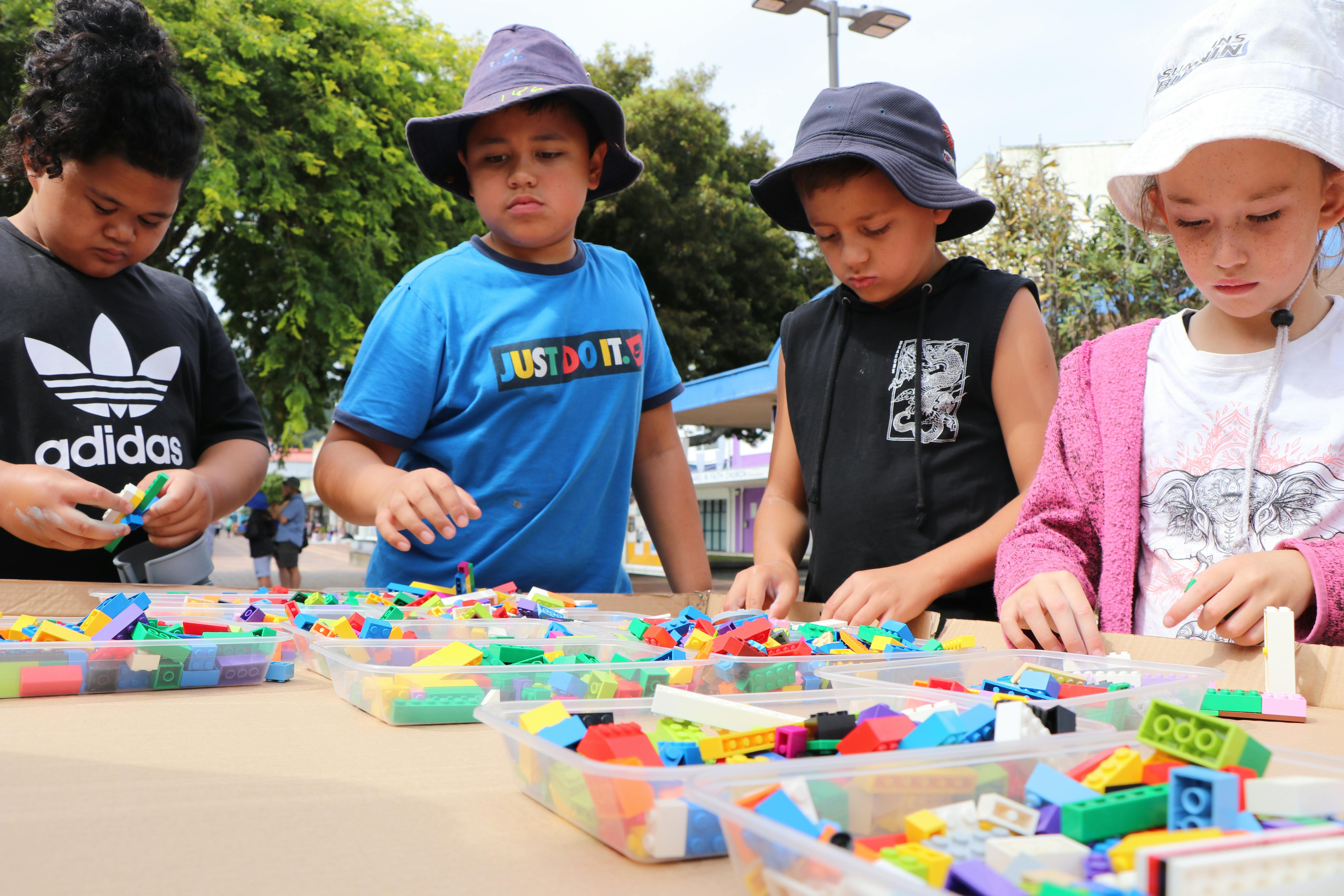
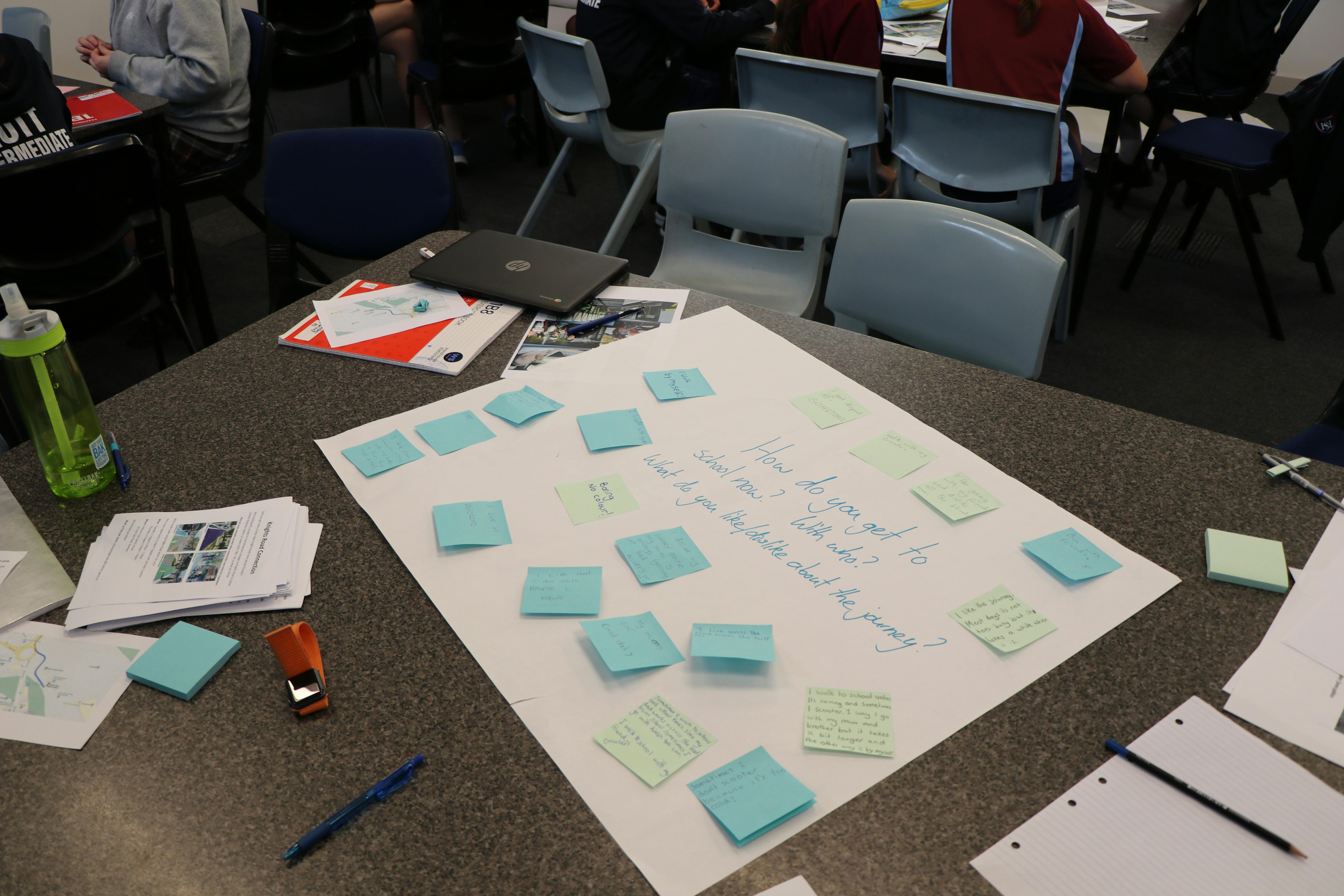
These surveys were live in terms 3 and 4 2020, asking about parents and students about transport to school. We would welcome more responses to these surveys - but some of the questions included are now obsolete. While the first trial is live, schools are measuring transport modes with their students, and we are also measuring directly on the roads.
Students
Do you go to school in Lower Hutt? Fill out our students survey to tell us how you travel to and from school. The survey is open to all students in years 7-13 who go to school in Lower Hutt.
Parents
Are you a parent or guardian with kids at school in Lower Hutt? Fill out our parents travel survey to tell us how your kids travel to and from school.